The Lost Towns
Dana, Enfield, Greenwich and Prescott
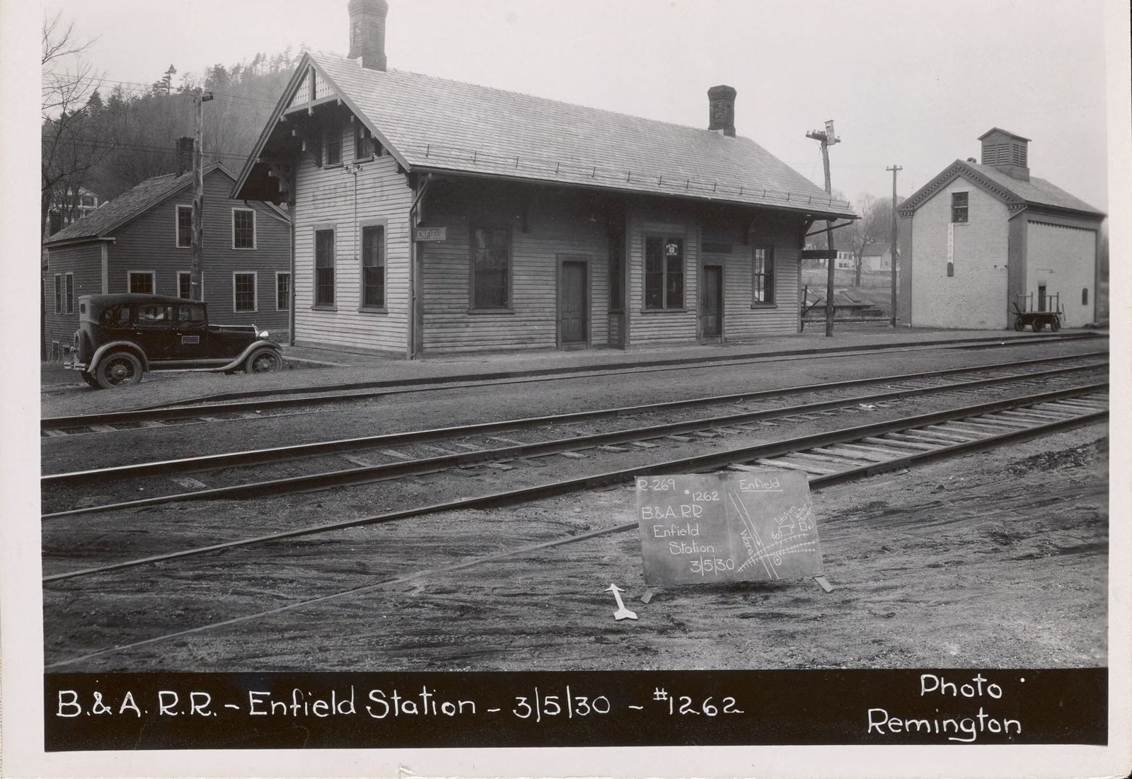
Four Massachusetts towns were removed to build the Quabbin Reservoir: Dana, Enfield, Greenwich and Prescott, in the Swift River Valley. All four were disincorporated on April 28, 1938, about 2,500 people moved away, over 1,100 buildings were cleared, and 34 cemeteries were dug up and moved. Enfield's center is under water. Dana Common is still on dry land and you can walk to it.
People often call them the "drowned towns" or the "lost towns." Not all of each town went under; much of the old land is now forest inside the Quabbin Reservation, crossed by the old town roads that walkers use today.
The Four Towns at a Glance
Dana
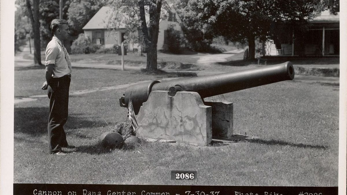
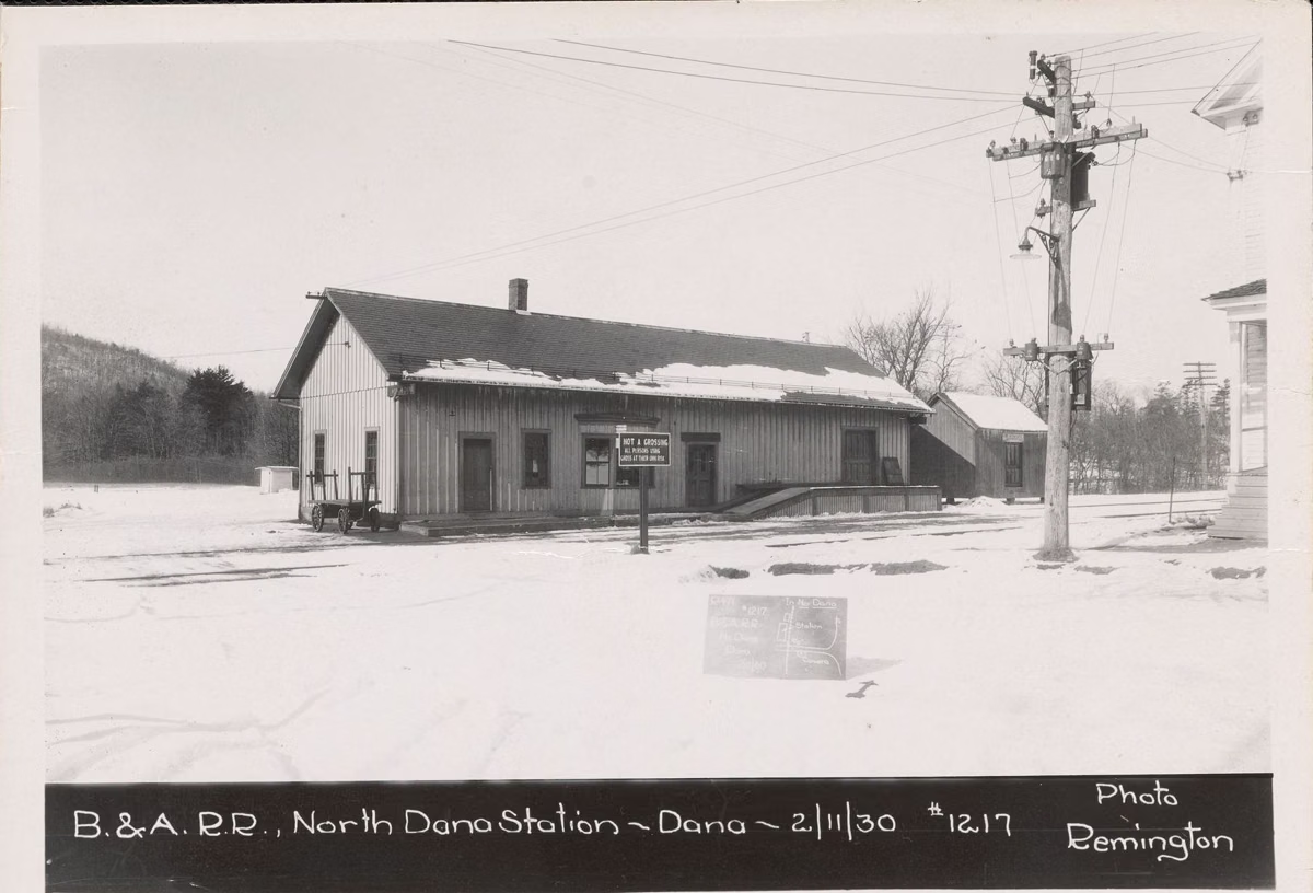
Dana was incorporated on February 18, 1801, and later took in parts of Hardwick and Petersham. It had a soapstone quarry in the northern part of town from 1852, a hotel built in 1835 that became the Eagle Hotel, and a population of 595 in 1930 and 387 in 1935, by the Friends of Quabbin's counts. DCR's Dana Common guide says the last town meeting was held in March 1938 and the last resident had left by the end of that year. When the buildings were auctioned, the school sold for $110 and the town hall for $90.
Dana's center was not flooded. Today it is Dana Common, reached on foot from Gate 40 in Petersham, with cellar holes, the school and town hall foundations, a row of granite posts from the cemetery fence, and the stone bases of monuments that were moved to Quabbin Park Cemetery. It was listed on the National Register of Historic Places in 2013 as the Dana Common Historic and Archaeological District.
Enfield
Enfield was carved out of Greenwich and Belchertown and incorporated on February 15, 1816. The Friends of Quabbin chronology lists the Swift River Company making cotton goods from 1821, a cotton mill at Smith's Station (Enfield's upper village), a brick town hall built in 1884, and the Quabbin Club, a women's club founded there in 1897. It had 1,056 people in 1830 and about 495 in 1935.
Enfield's town hall hosted the Farewell Ball held as the four towns were dissolved. DCR describes Enfield Lookout as looking over the former location of the now-submerged town. Webster Road in Quabbin Park was once Long Hill Road, which ran out from the center of Enfield toward Ware.
Greenwich
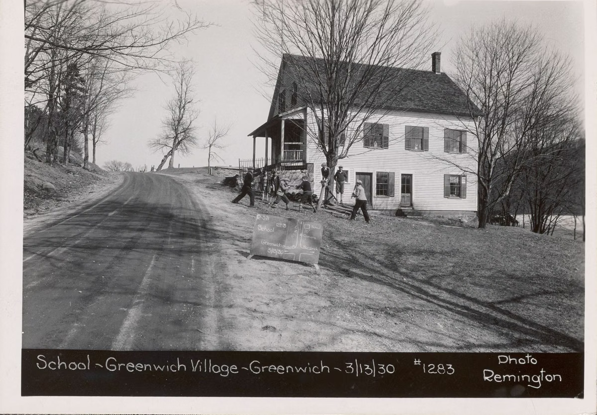
Greenwich was the oldest of the four. The valley's first church went up at Greenwich Plains in 1744, the area became the Quabbin parish in 1749, and Greenwich was incorporated on April 20, 1754. In 1837 its palm-leaf hat makers turned out 30,000 hats. Its population fell from 813 in 1830 to 219 in 1935.
Prescott
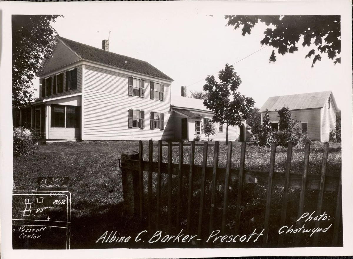
Prescott was the smallest of the four by 1900. Conkey's Tavern, built in 1758 in what became Prescott, is where Shays' Rebellion was plotted, according to the Friends of Quabbin chronology. The town held its centennial in 1922, but by then it was emptying: its post office closed in 1924, its last town meeting was in 1928, after which the water commission ran the town, and by 1935 only 18 people lived there.
Two of its churches survive elsewhere. The Prescott Congregational Church building was bought and moved to Mount Holyoke College in 1930. The Prescott Methodist Church was bought from the state for $5 in 1949, moved to Orange, and moved again in 1985 to the grounds of the Swift River Valley Historical Society in New Salem. Prescott Peninsula, named for the town, has been closed to the public since 1941 (see Quabbin history).
Population of the Four Towns
- 1830: Dana 623 · Enfield 1,056 · Greenwich 813 · Prescott 758
- 1900: Dana 790 · Enfield 1,036 · Greenwich 491 · Prescott 380
- 1920: Dana 599 · Enfield 790 · Greenwich 399 · Prescott 236
- 1930: Dana 595 · Enfield 497 · Greenwich 238 · Prescott 48
- 1935: Dana 387 · Enfield 495 · Greenwich 219 · Prescott 18
Figures from the Friends of Quabbin chronology.
Where to See the Lost Towns Today
- Dana Common (Gate 40, Petersham): the most complete town site you can walk to.
- Enfield Lookout in Quabbin Park: the view over Enfield.
- Webster Road in Quabbin Park: cellar holes and stone porch pillars of valley homes. See the trail map.
- Quabbin Park Cemetery in Ware: the four towns' war memorials and most of their graves.
- The Swift River Valley Historical Society in New Salem, which DCR calls the leading resource preserving the artifacts, stories and records of the lost towns.
Looking for a relative? DCR keeps the vital records of the four towns at the Quabbin Administration Building in Belchertown, and the visitor center can look up cemetery lots.
Lost Towns FAQ
What towns were flooded by the Quabbin Reservoir?
Dana, Enfield, Greenwich and Prescott. All four were disincorporated on April 28, 1938 and about 2,500 people were moved out.
Can you see the drowned towns of the Quabbin?
Parts of them. Dana Common is on dry land and you can walk to it from Gate 40. Enfield Lookout looks over where Enfield stood. Cellar holes and stone walls line old roads like Webster Road in Quabbin Park.
Is Dana, MA, a real town?
Not anymore. Dana was incorporated in 1801 and disincorporated in 1938 for the reservoir. Its town center survives as Dana Common, a National Register historic district.
Where was Greenwich, MA?
In the Swift River Valley, now under and around the Quabbin Reservoir. Greenwich was incorporated in 1754, the earliest of the four lost towns.
Where is Prescott, MA?
Prescott was a Swift River Valley town disincorporated in 1938. Prescott Peninsula, named for it, has been closed to the public since 1941.