Quabbin History
How the Swift River Valley became a reservoir
The Quabbin Reservoir was built between 1926 and 1946 to give Boston a large, clean water supply that could flow east by gravity without filtration. To make room for it, Massachusetts took the Swift River Valley: the towns of Dana, Enfield, Greenwich and Prescott were disincorporated on April 28, 1938, and about 2,500 people were moved out. The reservoir began filling on August 14, 1939 and was full in 1946.
The name comes from a Nipmuc word that DCR translates as "a place or meeting of many waters." DCR notes that the reservation lies within the lands of the Nipmuc, Pocumtuck and Pennacook nations, and describes the valley before the reservoir as a plain of ponds and rivers that became a busy farming valley and resort area.
Key Dates
Why Boston Looked West
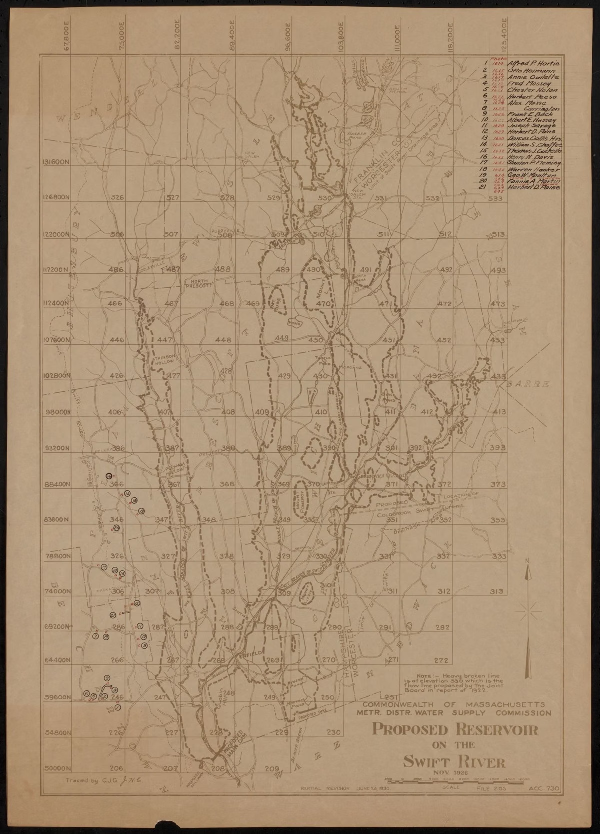
Boston's water came first from wells and Jamaica Pond, then from Lake Cochituate (1848), the Sudbury system and, in 1908, the Wachusett Reservoir. The MWRA calls Quabbin the city's fourth westward reach for a pure upland source that could be delivered by gravity and wouldn't need filtering. The idea took shape in a 1922 report by the Metropolitan District Commission and the Department of Public Health that recommended diverting the Ware River and building a large reservoir in the Swift River Valley, according to the Friends of Quabbin chronology.
The Laws: 1926 and 1927
Two laws made it happen. A 1926 law, Chapter 375 of the Acts of 1926, created the Metropolitan District Water Supply Commission, gave it the power to take land and water rights by eminent domain, and allowed up to $15 million in bonds. Work began that year on a tunnel to send Ware River floodwater to Wachusett. The Swift River Act of 1927 paid for the reservoir itself, and with it the decision that the four valley towns would go. Frank E. Winsor was the project's chief engineer from 1926 until his death in 1939.
Emptying the Valley
The state bought land for years before it flooded anything: about 40,000 acres by 1930 and 60,000 by 1934, the chronology says, and in the end 81,000 acres. On March 28, 1938, the land still unsold was taken by eminent domain, and on April 28, 1938 the four towns ceased to exist. A Farewell Ball was held in the Enfield Town Hall.
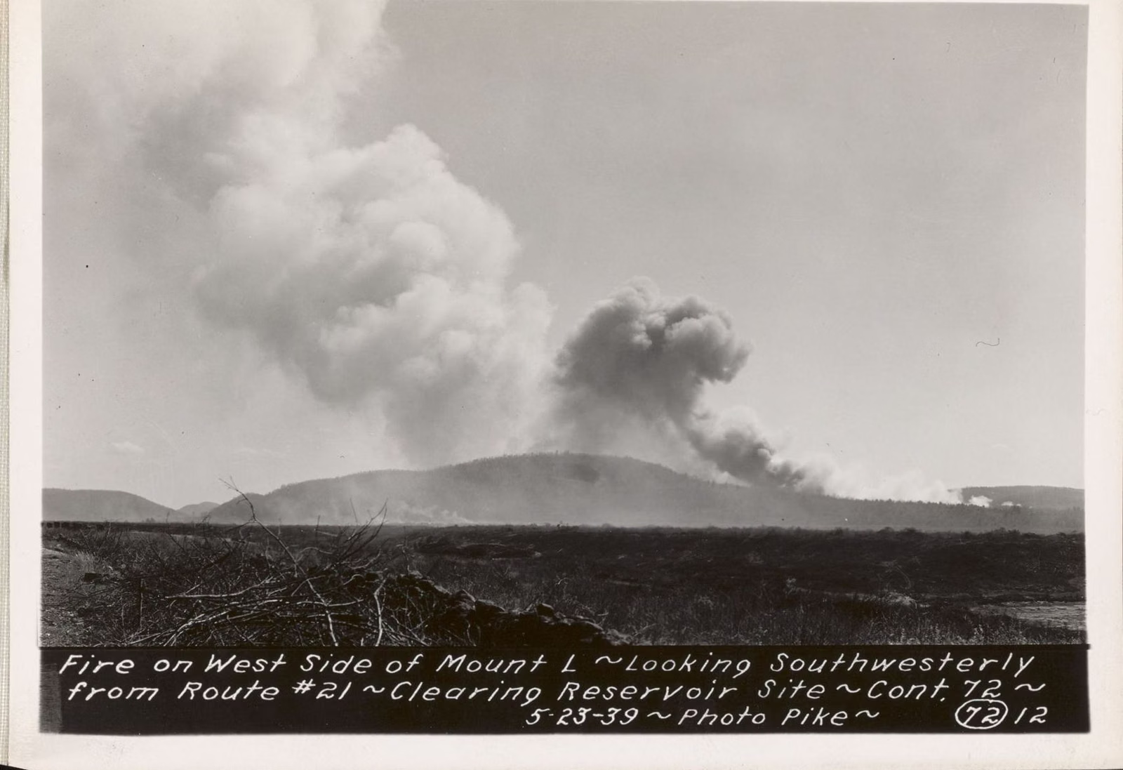
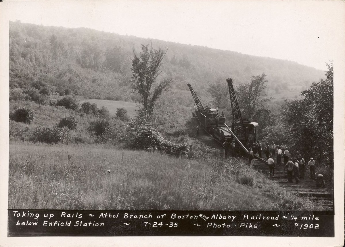
DCR's account of what went: homes and businesses, a state highway, a railroad line and 34 cemeteries, with over 1,100 buildings cleared. The railroad was the Springfield-to-Athol line through the valley, nicknamed the "Rabbit Run," 48 miles long with 20 stops; its last run was on June 1, 1935. Crews nicknamed "woodpeckers" cleared every tree and bush from the valley up to ten feet above the future waterline. The graves were moved too, most of them to Quabbin Park Cemetery in Ware. The towns themselves have their own page: the lost towns of the Quabbin.
Building the Dams
Construction on the reservoir began in 1936, the MWRA says. The Swift River was diverted around the dam site by a tunnel in 1933. Two earthen dams closed the valley: Winsor Dam across the Swift River and Goodnough Dike, completed in 1938. The project survived a flood in March 1936 and the September 1938 hurricane, which raised the river 15 feet at Winsor Dam and blew down millions of board feet of timber in the watershed.
Filling: 1939 to 1946
Water began to rise on August 14, 1939. In 1941 the first Quabbin water went through the aqueduct to Wachusett Reservoir, and the Quabbin Tower was completed. The reservoir was full in 1946, when water first flowed over the spillway; the Friends of Quabbin date it to June 22, 1946, and put the cost at about $53 million. At 412 billion gallons, the MWRA says, it was then the largest man-made reservoir in the world built only for water supply.
Prescott Peninsula
Prescott Peninsula takes its name from the old town of Prescott. In 1941 it was closed to the public and used by the Army Air Corps for bombing practice. A 1972 state law, Chapter 737, known as the Kelly-Wetmore Act, kept it a permanently restricted area, and DCR's access rules still list it as closed to walkers today.
Opening to the Public
- 1945: the dam and dike area opens to the public (Friends of Quabbin).
- 1946: shore fishing is allowed for the first time.
- 1952: boat fishing follows.
- 1982: the first bald eagles are released at Quabbin. DCR now counts the reservoir among the few places in Massachusetts where bald eagles and loons consistently nest.
- 1984–85: a new law splits the old Metropolitan District Commission's water job. The MWRA takes over delivering water; DCR's Division of Water Supply Protection keeps the reservoir and its watershed.
- 1988: the state marks a "Year of Remembrance" for the 50th anniversary of the towns' disincorporation.
Quabbin Today
Quabbin supplies drinking water to 2.7 million people in 53 communities. DCR manages the land around it as healthy, diverse forest to protect water quality, and that is why the rules are strict: no dogs, no swimming, no camping. For what you can do, start with Quabbin Park and the visitor center. Current reservoir levels are on water level.
History FAQ
Why was the Quabbin Reservoir built?
To give metropolitan Boston a large, clean water supply that could reach it by gravity without filtration. It was Boston's fourth westward move for water, after Cochituate, Sudbury and Wachusett.
When was the Quabbin Reservoir built?
Tunnels began in 1926, the Swift River Act passed in 1927, reservoir construction began in 1936, filling started on August 14, 1939, and it was full in 1946.
What does Quabbin mean?
It comes from a Nipmuc word that DCR translates as "a place or meeting of many waters."
How many people were displaced by the Quabbin Reservoir?
About 2,500, from the towns of Dana, Enfield, Greenwich and Prescott, which were disincorporated on April 28, 1938.
Can you go on Prescott Peninsula?
No. Prescott Peninsula has been closed to the public since 1941 and is a permanently restricted area under a 1972 state law.
How much did the Quabbin Reservoir cost?
About $53 million, according to the Friends of Quabbin chronology.